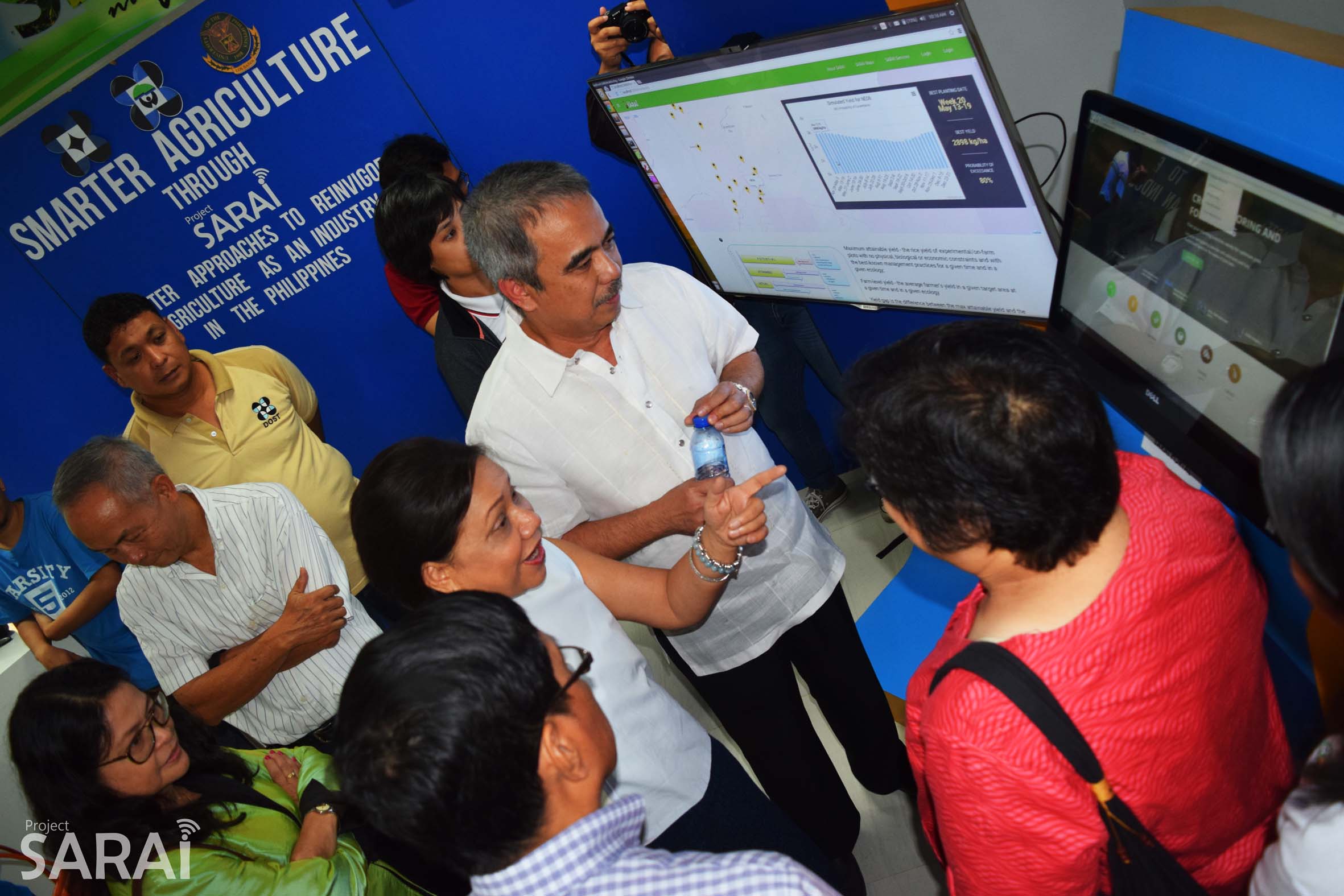
Smarter Agriculture – The project Smarter Approaches to Reinvigorate Agriculture as an Industry in the Philippines (SARAI) joined Department of Science and Technology-Philippine Council for Agriculture, Aquatic, Forestry and Natural Resources Research and Development’s (DOST-PCAARRD) SIPAG Fiesta Exhibit, held at DOST-PCAARRD Technology and Innovation Center (DPTIC), March 2-4, 2016.
DOST Seceretary Mario Montejo and Undersecretary Amy Guevara visited Project SARAI’s exhibit during the first and last day of the exhibit to view and comment on the project’s current outputs and efforts in pushing for smarter agriculture.
Project SARAI showcased five systems and technologies during the exhibit: cost-efficient soil moisture sensors and meters; Smarter Pest Identification Technology (SPId Tech); SARAI-Enhanced Agricultural Monitoring System (SEAMS); automatic weather station (AWS) and unmanned aerial vehicle (UAV); and SARAI Knowledge Portal. All these technologies contribute to refining a smarter agriculture sector, and smarter farming communities.
SARAI Systems and Technologies
1. Cost-efficient soil moisture sensors and meters
These are fabricated soil moisture meters are installed in selected experimental sites for monitoring soil moisture content. Through proactive monitoring, farmers can easily decide when to increase the water level in their farms.
2. Smarter Pest Identification Technology (SPI Tech)
It works like Facebook face recognition each time you want to tag a friend; only that, this time, we’ll be uploading pictures of pests. SPId Tech can identify rice and corn pests through images. Farmers and technicians can upload real-time pest infestation, and the application can identify the pest, and recommend immediate pest management control actions.
3. SARAI-Enhanced Agricultural Monitoring System (SEAMS)
SEAMS uses free and daily updated satellite images from US and Europe. These satellite images are used for near real-time monitoring of the actual area planted to rice and corn. Other uses of SEAMS include land use change, vulnerability assessment, identification of possible breeding grounds of major insect pests, and weather condition in areas without weather stations.
One output of SEAMS is the crop damage assessment in Nueva Ecija rice farms right after typhoon Lando. The assessment provided the Department of Agriculture Operations (DA Operations) clearer figures of the damages areas, and the areas that can still be replanted with rice.
4. Automatic Weather Station (AWS) and Unmanned Aerial Vehicle (UAV)
Project SARAI has installed AWS in various SUCs nationwide to have a near real-time access to the different weather parameters in cropping areas. The UAV, installed with a multispectral camera, is used to fly over vegetation areas; and the team is refining how to better analyze the images. Possible analysis could include crop health, and spread of pest infestation.
5. SARAI Knowledge Portal
This online knowledge portal houses all the outputs and systems of the program. One special feature of the SARAI knowledge portal ae the interactive maps where the visitors can easily see various information such as: crop suitability maps and vulnerability maps.
Project SARAI is a three-year research program funded by DOST-PCAARRD which aims to develop a crop forecasting and crop monitoring system for six priority crops – rice, corn, coconut, banana, coffee and cacao. Major outputs of the system include planting dates; site-specific nutrient, water, and pest management; crop suitability maps; agricultural monitoring system; SARAI knowledge portal; and capacity building workshops. (Heidi D. Mendoza)

